A discussion on pre-survey issues is worth mentioning. Since 1985, I have read and reviewed many documents that attempt to define how to conduct and obtain geophysical surveys. The roots of some of the documentation came from laboratory requirements, government agencies, manufacturers, or practical experience. Most of the material I am familiar with is for near surface geophysical applications. Below is an overview of some important factors. Generally, I agree with the intent. In practice, it can be difficult to comply since geophysical field surveys are not the same as laboratory testing results. Given that every geophysical survey is a unique situation, one needs to apply a level of common sense that comes from experience. However, today there seems to be many different ideas of common sense. Thus, we frequently depend on standards to fill in for hard work and practical experience.
Many factors contribute to good professional services for mapping bedrock. Specifically, there are discussions prior to any services that pertain to contracting, experience, and issues pertaining to quality. Bedrock mapping involves collecting data and factors in site conditions, soils, groundwater, bedrock, and other concerns. Above all, the final product is an interpretation of the results for others to integrate into their programs. Qualified professionals can assist with the design and implementation of a bedrock mapping survey for infield verification. Survey design integrates existing information to meet the objective and suggestions for reasonable levels of detail or resolution. The implementation of a bedrock mapping program requires qualified field personnel to make field observations, acquire data, and deliver a final product.
Pre-survey discussion.
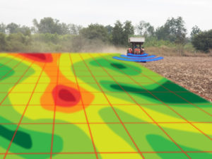
Near surface geophysical methods assist with finding solutions for agricultural consultants, environmental specialists, and geotechnical engineers. As presented throughout this website, only drilling or excavating can provide direct evidence to the conditions at depth. But only at a single location. The costs are often steep for these services. In contrast, geophysical methods are indirect and cost less. However, a geophysical investigation’s indirect approach makes it dependent on knowing true site conditions. Thus, it is important to present to the geophysicist or other qualified person with all the information available about the survey area and any known ground truthing activities. Integrating geophysical results, available history, and a ground truthing program should yield desirable results. Here is a list of example questions.

What is the goal?
For the property of interest, is the goal to map soils, bedrock, or both? Are there other features of interest like karst features, faults, fractures, or groundwater issues? What is the depth of interest (e.g. two to three feet, three to five, five to twenty feet, or greater than twenty feet)? A discussion with the regulating agency may offer some insight.
Site history?
What information do you have available about your site? Are there geologic maps, site maps, boring logs, or hazards and safety conditions that may impact the field work, etc.? Be aware that poor introductory information may lead to a misinterpretation of the geophysical results, which could lead to additional costs for further and potentially unnecessary analysis. How good or bad is access to the site?
Size of the survey area?
How large of an area do you wish to survey? Is there more than one parcel? If so, how many? How far apart are they?

A discussion on the goals for mapping bedrock involves the size of the operation.
Desired resolution?
A discussion on the level of detail, both vertically and laterally, will streamline the approach. Have any agencies provided recommendations?
What anecdotal information is available?
Is there anyone who has working knowledge of the site that can add details?
Type of soils?
What are the soils like? Has anyone excavated or tested the soils? If so, how deep and how far apart?
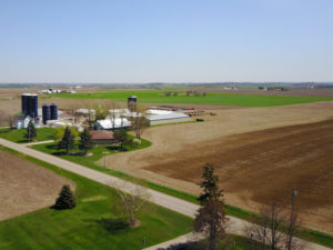
Topography?
What are the surface conditions? Is the site fairly flat, hilly, or broken up into smaller areas because of physical features?
Topography at a site caused by streams or drainage ditches may play an important role in survey design
What obstacles and cultural features are encountered?
Discuss site features that may be of interest. Some examples are wetlands, utility corridors, sources of interference, buildings, wells, vegetation, wooded areas, ponds, fences, crops, drain tiles, ditches, surface water, or animals.
Consider available approaches.
Would a phased approach with a preliminary site evaluation be useful? As mentioned at other places on the website, one can focus on different levels of effort and confidence.
Deadlines Deliverables.
How soon does one need results? Are there restrictions in place that limit the use of the land? Does one simply need results presented as plots or is a detail report necessary?
Miscellaneous.
Safety is always a major concern. Are there any onsite hazards to watch out for? What insects, biohazards, or chemicals are a safety issue? Any farm animals an issue? From a logistic point of view, are there issues with getting on and off the premises? Will there be third-party observers? Is there a secure staging area to work from?
Assistance with contracting or hiring professional services.

What obstacles and cultural features are encountered, like fences?
When seeking professional services, the parties involved come to an understanding as to the objectives, site conditions, assumptions, approach, deliverables, costs, and other information that may affect the services. For geophysical services, an objective is often straightforward. Providing customers with a reasonable understanding of the circumstances involved and the proposed approach is often a greater task. An appreciation of the site conditions, geophysical methods, and assumptions factor into helping the customer understand how to plan to meet the objective. There are no guarantees with indirect methods like geophysical surveys. In fact, the results may reflect an unexpected highly complex set of geologic conditions. In other words, additional analysis may be necessary.
Understanding the site above and below the ground.
The site is the physical location where the geophysical services take place. There are conditions above and below ground that affect the results. Surface conditions and geology are primary factors that drive the approach and the cost. Thus, good answers to the pre-survey questions above are very important. I have had it where a customer, wanting to test my skills as a geophysicist, did not disclose some very important details. Though most of the time it turns out, there have been occasions where knowing the details would have led to a different and more cost effective approach. To repeat, hindsight is 20-20.
Survey methods, survey design, and acquisition parameters.
An understanding of the objectives and site conditions, more or less, determines the geophysical methods, survey design, and amount of data to collect. Lower levels of effort cost less, but may lead to undesirable or misleading results. Without doubt, this is not necessarily a reflection of the quality of the results (discussed below). One can have very precise and accurate measurements from a few locations. However, a few locations may not produce a valid representation, which is often the case with a drilling program. Depending on the amount of data, maps can lead to false positives and false negatives, due to aliasing. Low volumes of data can mistakenly map areas indicating shallow depths to bedrock. In addition, areas that show deeper rock can actually have less soil. In short, the results of a geophysical investigation with 1000’s of measurements will assist in improving maps of existing conditions that are based on direct observations, historical records, or drilling.
Are there any dangerous conditions or hazards?
In summary, a major factor in higher quality presentations or maps is that the level of detail agrees with the volume of data analyzed. It is common to see plots that have detail that exceeds the amount of data inputted into the graphic presentation. Today, with computer software, it is easy to generate an excessive amount of detail from too few data points. The outcome is that the maps may not be a reasonable approximation of the data. When this occurs, interpretations, no matter how detailed or well thought out, are probably misleading. This is not always the case; however, it happens. This can also occur when results lead to computer generated models. In other words, models may demonstrate more detail than the available data. While this may be difficult to avoid, interpretations can filter out situations that are overstated.
Deliverables.
For agencies to approve the conclusions of a report provided for an infield bedrock verification program, the report must include various details. A written report presents many of details discussed above. First, one should state the objective and scope of the services. Second, the report should include a summary of the instruments, methodology, some theory, an indication of the amount of data, processing, interpretations, and potential limitations. Finally, professionals will need a summary of the interpretations and final thoughts. Though sometimes difficult to produce, the end product should be a user friendly discussion.
Payments.
Many professionals charge by the hour, especially larger firms. In my opinion, I feel that a lump sum approach is beneficial for the customer as well as the group providing the services. In other words, everyday professional services that are common practice for a consultant should be easy to price as a quantity defined by the proposed approach.
I see no reason why seasoned professionals cannot provide a lump sum amount or some type of unit cost for their services. This makes perfect sense for the client, since a well-written proposal details the services and gives the customer a clear idea of the cost. On the other hand, it may be necessary to provide a proposal that charges on a time and materials basis. This approach is common but can lead to costs that the end user did not expect. Depending on who is procuring the services, partial payment may be required in advance, unless arrangements are agreed to for payment at a later date.
Assistance with determining qualifications.
First, geophysical services require a knowledge of math, physics, and geology. Second, a familiarity of the instruments combined with good field methods produces a good final product. Not all of the personnel need an extensive education. However, someone with a geophysical background needs to be close by to supervise the project. Here are three very general groups of people whose roles depend on their experience and background. Undoubtedly, this discussion about these roles does not cover all types of employees.
Management
As a starting point, it seems appropriate to have a licensed registered professional and a full-time employee who is dedicated to these types of services (e.g. geophysics, geology, civil engineering, structural engineering, etc.). It is appropriate that they should also have a minimum of five years of engineering and/or scientific experience in disciplines associated with these services (e.g. geophysics, geology, civil engineering, structural engineering, etc.). While a registered profession is preferred, there are those with over ten years of experience directly related to geosciences that should have no issues with the design and implementation of these services. A person of this level should be proven and well versed in handling and archiving data sets, documentation, processing, interpretation, analyses, and reporting.
Supervising Technician
It is reasonable for a supervising technician to have a minimum of five years of experience related to geosciences. A supervising technician needs to demonstrate a proficiency to perform associated tasks. This level of experience implies the person is capable of determining if the services conducted are acceptable for a final product. They should also have enough exposure to the report process to understand what is expected in the final product.

Use qualified professional geophysicists, geologist, and engineers.
Technician
Technicians are crucial for fieldwork and other tasks that support supervising technician’s and management’s responsibilities. A person of this level needs a high school diploma, an equivalent, and/or trade school training. On the job training is necessary to obtain a working knowledge of how to carry out the services. The person must demonstrate an acceptable level of competency for the assigned tasks. Regular supervision is required.
Field personnel, which includes technicians and management, must have instrument specific training and demonstrate a sufficient level of proficiency to carry out the task. The person must be adept at differentiating between good and bad data, take good notes, and physically capable and willing to work in the field. Some projects may require quick assessments. In situations that require flexibility and onsite decisions, one needs additional experience with data processing and with making limited interpretations.
Assistance with quality.
Quality for geophysical services is not the same as lab tests. Yet, there are common factors. First, geophysical instruments must be in good working order. Equipment must function and operate per the manufacture’s recommendations. All instruments have limitations. The manufacture’s manuals, reference papers, and field experience assist with determining if an instrument is capable of meeting the goals. The difficult part is that the indirect nature of geophysical methods does not lend itself to an immediate answer. Though seldom, sometimes it is not until after a significant amount of time passes before one can confirm if the services will yield desirable results. However, good correlations with known conditions will validate the quality.
Instrument operation.
Although experience with geophysical instruments improves the quality of a geophysical survey, the operation of most instruments is well defined by the manufacturer. In addition to explaining how the equipment operates, the documentation may point out the importance of good battery management, survey design, limitations, and field notes (e.g. survey marks, field conditions, and other pertinent information). In many cases, one simply needs to familiarize themselves with the manufacturer’s manuals, training videos, and other supplemental material. After securing a good working knowledge of how the instrument operates and its limitations, one needs experience. Taking time to use the equipment on tests sites is a must. The learning curve can be steep. With time, one will reach a level of confidence that they can take to the field.
Calibration.
While calibration is very important in a lab, in my opinion, it is somewhat overstated for the most part when it pertains to geophysical fieldwork. Geophysical instruments are designed to endure rugged environments. This does not guarantee that after an instrument leaves a manufacturer, it continues to function properly. Thus, quality is often best maintained by using common sense and field testing equipment provided by the manufacturer to confirm an instrument is operating per their specifications. Base line readings or base stations can demonstrate repeatability and/or provide measurements that allow one to adjust for drift. Instrument drift is common and is taken into account when there is a change in instruments, long periods between data acquisition, changes in weather, or changes in site conditions.
Good field notes about a base station or base line measurements include details about the location, time, date, orientation, weather, instrument configuration, noise levels, battery levels, and settings. Periodically revisiting the base can reveal problems with the equipment, offers a way to correct for instrument drift, and demonstrates repeatability. A base is also a place to get started on a site. A shake test on the instrument and cables can reveal bad connections or intermittent problems with electronics. These tests demonstrate that all is in order before going out to collect data.

Repeatability, calibration, and quality lead to good bedrock maps.
Field documentation.
Notes and photographs on new borings and test pits are valuable resources for an ongoing geophysical investigation. It is a great place for real-time correlation of the results and a discussion about possible limitations. A review of this type of direct observation my lead to reevaluating the current approach.
Data transfer, storage, and archival.
Downloading data and storing it for post processing is somewhat obvious. However, many times I have heard of people storing hours and even days of data without copying it to a second storage device. In worst case scenarios, they found that files were corrupted, lost, or the wrong file format. As often as possible, one should download data from an instrument and copy it to two or more locations. Today, memory sticks are a good, inexpensive choice. In addition, secure cloud storage is a great place to store data, since paid providers commonly take great care to make sure data is safe and secure.
Resolution.
Resolution is the ability to differentiate between targets or zones of interest. It may pertain to differentiating between layers of soils, rock, or the ability to detect or delineate karst features, fractures, and or faults. Geophysically, cost frequently limits the level of effort before one reaches the maximum resolution. Finally, geophysical results with poor definition goes hand in hand with lower levels of effort.
I have mentioned many times that geophysical instruments respond to conditions at depth. Measurements acquired with great precision reflect current conditions. Some results demonstrate great detail, which is of little or no use. Many times the greater problem is not resolution or precision, it is man’s limitations to understand or interpret the results. If geophysical results do not agree with current conditions, one may need to reanalyze the data or acquire additional data. For sites that are being drilled or as additional information becomes available, geophysical data may reveal anomalies that were once of little or no interest.
Real time data processing, analysis, and interpretation.
While real-time post processing is desirable, it can get expensive and cut into field time. A geophysicist should review or process data every evening, to make sure the investigation is progressing as planned. This level of effort may be acceptable and prove to be a cost effective approach. When real-time processing is not available, the greater question involves site access and the distance a consultant would need to travel to reacquire questionable results. Unlike larger companies that often charge for time and materials, a smaller independent consultant can quote lump sum costs and anticipate the need for real time processing. In addition, an independent may be more forgiving with costs when it comes to revisiting a site that is less than a few hours away. In contrast, those who bill time and materials may charge extra for real time processing and the time it take to revisit a site.
By all means, real time processing plays an important role in geophysical surveys. The need for additional data (e.g. more closely spaced lines or perpendicular lines), the strategic placement of high-resolution methods, or real time error analysis can improve the final analysis. However, it takes someone with greater experience than a field technician to interpret the geophysical data, which may increase the cost.
Ground truthing, drilling, and correlation.
Drilling cannot provide the horizontal detail that geophysical surveys provide. Drilling logs pertain to a specific location. By all means, drilling, excavation, and other methods of ground truthing are necessary. These methods of direct observation combined with geophysical measurements are a powerful combination. A discussion is available in other parts of this site about this topic.
Conclusion.
In my opinion, pre-survey discussion, contracting, qualifications, and quality drive a final product. Geophysical results need to be repeatable and correlate with known information. However, geophysical survey results can be complicated. First, geophysical results do not characterize a single point like a borehole. Thus, a report provides an overall picture that may not agree exactly with all borings. Additionally, geophysical instruments respond to physical conditions; thus, the data, given it is repeatable, reflects the conditions during the testing. If the geophysical results do not agree then one must reconsider the approach or reanalyze and reinterpret the data.
Above all, the instrument responds to what is below the ground, whether or not we understand it or not. I have seen a disturbing number of cases where the geophysical results did not correlate well and the anticipated answer. Quickly, others would comment that geophysical methods don’t work. Personally, I find that either the geophysical consultants failed to implement a reasonable approach followed by a good interpretation of the results or preconceived ideas took precedent over the geophysical services. Over the years, I have seen geophysical results that did not agree with the clients first expectations. More than once, which may have been years later, I was told the geophysical results were correct and the services were instrumental in changing years of preconceived notions.

Glossary of Definitions and Terms for Mapping Bedrock
How much land is needed for a livestock nutrient management program?

What areas benefit the most from an infield bedrock verification survey?

Summary of the HYDROGEOLOGICAL CHARACTERIZATION OF THE TOWN OF LINCOLN, KEWAUNEE COUNTY, WISCONSIN
What is top of bedrock?

Geology, Groundwater, Geophysics, and WI DNR NR 151 Runoff Management Standards

A History of Groundwater Protection Past Present and Future

References and links for agricultural professionals, farmers, engineers, geologists, geophysicists,…