Contact form is located at the bottom of this page.
Geophysical Services LLC (Established 1985)
A geophysical service company.
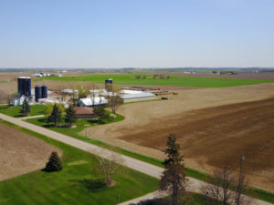
Without doubt, Geophysical Services LLC has a hands-on approach. The geophysical service provider focuses on near surface applications that include environmental issues, mining, archaeology, and engineering. Thus, it is common practice and straightforward for the company to provide well established geophysical methods like those discussed in this web site, to agricultural facilities, farmers, and professionals.
K. D. Jones Instrument Corp started in the 1980’s
A geophysical equipment rental company.
K. D. Jones Instruments transitioned from a company specializing in equipment sales, B. R. Jones & Associates, to one that sold and rented geophysical equipment. Large companies as well as individuals throughout the world rent geophysical equipment. While many sales and rentals are within North America, most are within the United States. Customers rent from us because of our customer service (generally available 24 hours a day and 7 days a week) and working knowledge of the equipment we sell and rent.
Geophysical surveys for
Geology
Engineering (non-environmental)
Environmental
Hydrogeology
Real Estate Assessments
Multichannel Analysis of Surface Waves (MASW)
Electrical Resistivity Imaging or Tomography
Ground Penetrating Radar or GPR
Geometrics OhmMapper Capacitance Coupled Resistivity
GPS Mapping
Wind Farms
Mining
Frac Sand Exploration
Sand and Gravel Exploration
Private utilities and buried metal cables and pipes
Regions serviced
Menu – Links to Pages on BedrockMapping.com
- Guide to Mapping Bedrock in Wisconsin.
- Geophysics and Mapping Bedrock in Wisconsin.
- Cost and survey design for geophysical mapping of bedrock.
- Assistance with mapping bedrock pre-survey discussion, contracting, qualifications, and quality.
- Ground Truthing, Drilling, and Correlating Geophysical Results When Mapping Bedrock in Wisconsin.
- Geophysical Equipment Rental and Sales for Mapping Bedrock in Wisconsin.
- Geophysical Instrument Training for Bedrock Mapping.
- FAQ, Articles, and Posts About Geophysical Bedrock Mapping in Wisconsin.
- Manufacturers Like Geonics, Geometrics, Advance Geosciences, Sensors Software.
- Contact BedrockMapping.com
Countries:
United States and Canada.
States:
Wisconsin, Illinois, Iowa, Michigan, Minnesota, Indiana, and others
Major Cities:
Wisconsin-Milwaukee, Green Bay, Appleton, Oshkosh, Madison, Kenosha, Janesville, Wisconsin Dells, La Crosse, Wausau, Equ Claire, Superior. Illinois-Chicago, Rockford, Naperville, Peoria, Champaign, Springfield, Decatur. Indiana-Indianapolis, Gary, South Bend, Elkhart, Fort Wayne, Lafayette, Terre Haute. Iowa-Dubuque, Waterloo, Mason City, Des Moines, Davenport. Michigan-Muskegon, Grand Rapids, Kalamazoo, Battle Creek, Lansing, Ann Arbor, Detroit, Traverse City. Minnesota-Minneapolis, Duluth, Rochester, Winona, St Cloud, Marshall

Contact bedrock mapping for geophysical services, equipment rental-sales, and ground truthing.
Geophysical equipment and services
Electrical Resistivity Tomography, Profiling, and Soundings
Electrical Resistivity Imaging AGI SuperSting R8 with 84 electrode array
Capacitance Coupled Electrical Resistivity With Geometrics OhmMapper
Resistivity Soundings (AGI SuperSting, MiniSting, and Swift R1)
Electromagnetic Instruments
Geonics EM38 terrain conductivity meter (more or less 0.5 to 5 feet of penetration)
Geonics EM31 terrain conductivity meter (more or less 2 to 20 feet of penetration)
Geonics EM34 terrain conductivity meter (more or less 25 to 200 feet of penetration)
Seismic Methods and Instruments
MASW (Active MASW, Passive MASW, 1-D Profiling, and 2-D Cross-sections)
Seismic Refraction and Reflection
Seismic Shear Wave Surface to Borehole or Surface to Surface
Crosshole seismics (Ballard borehole source and Geostuff geophones)
Ground Vibration Monitor (Instantel Minimate, Blastmate, and Micromate)
Ground Penetrating Radar (GPR)
GPR Sensors & Software pulseEKKO 50 MHz, 100 MHz, and 200 MHz with Sensors & Software Ultra receiver
GPR Sensors & Software Noggin Systems 250 MHz and 500 MHz
Borehole Tools (Mostly Mount Sopris Tools)
Optical Borehole Imager OBI40-2G
Acoustic Televiewer QL40-ABI-2G
Natural Gamma and SP SPR 16 64” Normal Resistivity
Electrical Resistivity Probe IP and 4-point Resis QL40-ELOG
Normal Resistivity 8/16/32/64″
Gamma SP SPR Probe 40LGR-1000
Fluid Conductivity and Temperature QL40-FTC
3 Arm Caliper QL40-CAL
Geonics EM39 (borehole) Induction 2PIA-1000
Full Waveform Sonic 2SAA-1000 QL40-FWS
Impeller Spinner Flowmeter FLP-2492 QL40-SFM
Heat Pulse Flowmeter HFP-2293 Probe
Deviation QL40-DEV
Ballard Source and Geostuff Geophones
Miscellaneous Geophysical Methods
Line Locators (Dynatel, Pipehorn, Aquatronics, SubSurface Instruments, Fischer, and Radiotronics)
| Geophysical Services LLC PO Box 309 Mequon, WI 53092 Telephone No.: 262-242-4280 Email: Geophysics@GeophysicalServices.com |
K. D. Jones Instrument Corp PO Box 339 Mequon, WI 53092 Telephone No.: 262-442-6327 Email: Nate@KDJonesInstruments.com |
Have a great day.
Transportation:
Major truck lines, rail, and bus services provide ground transportation while airlines provide regional air transportation.
Facilities:
The office and shop provides 2500 sq. ft. of space for state of the geophysical equipment, geophysical testing, electronic repair, a machine shop, and vehicle and equipment storage.
One of many disclaimers
I must point out that much of what this site discusses is based on past experiences and reflects opinions. While the laws of physics behind the geophysical methods are well-defined and entrenched in theory, the problem for us, is whether or not we can understand and properly interpret the acquired results. The equipment responds to the earth. It is sometimes difficult to appreciate or interpret what the instruments are telling us.
This site was built with the best intentions. Though great effort is taken to provide good information, the reader is being notified that there is always the potential for a misunderstanding or misinformation. Only those who accept this and who agree to the terms and conditions are permitted access to this site. It is the reader’s responsibility to contact us with errors. This is different than if you don’t like what you see. Clearly, this site won’t tolerate bad behavior. Consequently, this site and the contributors are not responsible or liable for how the opinions and information are used or misused.

Glossary of Definitions and Terms for Mapping Bedrock
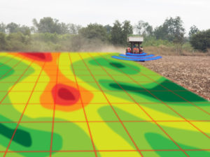
How much land is needed for a livestock nutrient management program?

What areas benefit the most from an infield bedrock verification survey?
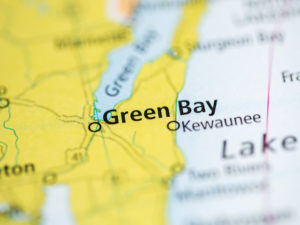
Summary of the HYDROGEOLOGICAL CHARACTERIZATION OF THE TOWN OF LINCOLN, KEWAUNEE COUNTY, WISCONSIN
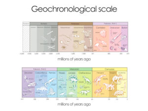
What is top of bedrock?

Geology, Groundwater, Geophysics, and WI DNR NR 151 Runoff Management Standards
A History of Groundwater Protection Past Present and Future

References and links for agricultural professionals, farmers, engineers, geologists, geophysicists,…