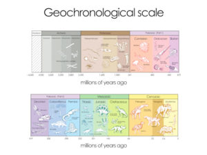
Assistance with mapping bedrock in Wisconsin is inspired by NR 151.
Mapping bedrock, geophysics, and drilling go hand in hand. There are logistical issues, administrative matters, and certainly concerns about survey design. The primary objective of this guide is inspired by Wisconsin DNR’s NR 151 requirements for infield bedrock verification. Hopefully, this site assists with how to map soil thickness or depth to bedrock. By all means, this site is not a replacement for user manuals, common sense, experience, or for the education necessary to map bedrock successfully. As a geophysicist (a licensed professional geologist/geophysicist who has conducted over 1000 geophysical surveys since 1985), I believe a background in physics, geology, geophysics, engineering, and/or mathematics will benefit survey designers and end users.
Without doubt, bedrock is susceptible to weathering, karst activity, fracturing, jointing, and faulting. Because currently available data does not offer enough detail for on-site evaluation, future studies will assist agricultural facilities, farmers, and government agencies to make better decisions. Currently, Wisconsin requires infield bedrock verification. WI DNR NR 151 defines “Infield bedrock verification” as determining “bedrock depth using available data which may include well construction reports, location of drill cores or other subsurface investigations, location of quarries and natural bedrock outcrops, geophysical investigations, and uneven crop growth patterns that are linked to fracture traces in the field.” Consequently, one will find a variety of topics addressed in this website pertaining to mapping bedrock and how it relates to WI DNR NR 151.
Below are short excerpts from pages within BedrockMapping.com. Click on the menu bar to the left or a subheading below to visit a specific page.
What is top of bedrock?
Often easier said than done. A bedrock surface can range from solid rock to something that appears almost like a sand and gravel. There is a trade off if one identifies the top of weathered rock verses the top of competent rock as the depth to bedrock. While mapping the depth to a competent bedrock surface may lead to greater depths, one could end up with a different soil texture classification, as discussed in NR 151. By incorporating the weathered zone as part of the soil thickness one will likely see a significant increase for the amount of course grained materials (sand and gravel content) in the soil analysis.
Geophysics and mapping bedrock section.
This page offers insight as to what is geophysics and how it applies to mapping bedrock. Although drilling is an excellent method for obtaining great detail at a specific location, it is not cost effective for mapping bedrock over tens, hundreds, or even thousands of acres. When mapping bedrock is a concern, utilizing geophysical methods may provide the necessary level of confidence for an acceptable infield bedrock verification. This section discusses soil conditions, rock properties, groundwater, drilling, and geophysical equipment. Methods include Geonics instruments (EM31, EM31, and EM34), OhmMapper capacitance coupled resistivity, electrical resistivity imaging, seismic refraction, multichannel analysis of surface waves or MASW, ground penetrating radar or GPR, and geophysical borehole methods.
Cost and survey design for geophysical mapping bedrock.
The cost of geophysical services to assist with an infield bedrock verification program is a great concern. This section discusses factors such as why geophysical methods are cost effective, why currently available data may be insufficient, survey design, resolution, and benefits of reclassification. One will find introductory costs for 2019. Basic tiers of geophysical services include:
1) Estimated costs for preliminary geophysical site evaluation: Option 1) observe the response from one to three geophysical instruments. Option 2) observe the geophysical response over spatially large areas with various lines spacings and instruments.
2) Large Scale Geophysical Surveys: Costs for geophysical methods intended to map lateral variations over spatially large areas.
3) Customized Geophysical Surveys: Estimated costs for customized geophysical services (e.g, electrical resistivity imaging, ground penetrating radar ( GPR ), and seismic methods.
4) Other factors: Depending on agency requirements one may need more than one approach.
Assistance with mapping bedrock pre-survey discussion, contracting, qualifications, and quality.
Mapping bedrock is more than fieldwork. The fieldwork comes after finding a good geophysical service provider and defining the goals. Without a doubt, a pre-survey discussion lays out the basis for desirable cost effective geophysical methods. Subsequently, the pre-survey discussion includes, in part, background history, survey size, and desired level of detail or resolution. These and other factors help determine the geophysical survey design, acquisition parameters, and a cost effective approach. Currently, there is not an abundance of professional geophysicists in the Wisconsin area. For that reason, customers need to have a good understanding about the deliverables, payments, how to evaluate qualifications, understand quality, and how to follow up with reasonably good methods for ground truthing and correlating the geophysical results.

What history do you have about your farm or agricultural facility?
Ground Truthing, Drilling, and Correlating Geophysical Results When Mapping Bedrock in Wisconsin
While ground truthing was touched on previously, there is much more to discuss. This section discusses why ground truthing is necessary, the horizontal and vertical resolution of direct observations, commonly accepted practices, pre-drill research, and finally drill hole layout, optimization, specifications and approach. Since direct observations vary, one can expect to end up with various levels of confidence. Hammering rods, shoveling, digging post holes, soil sampling, and hand held augering frequently provide low levels of confidence. Miniexcavators, skid steers with drilling accessories, backhoes, and direct push methods offer higher levels of confidence. The highest levels of confidence come from using auger type drill rigs, mud rotary drilling, air rotary drilling, diamond drill coring, and sonic drilling. All of the above offer different pros and cons and physical demands on the field personnel.

Nutrient Management and infield bedrock verification are about farm animals.
Geophysical Equipment Rental and Sales for Mapping Bedrock in Wisconsin
Looking for geophysical equipment? K. D. Jones Instruments Corp. offers a wide variety of equipment that is appropriate for mapping bedrock. I suspect there will be few bedrock mapping surveys that don’t incorporate either Geometrics OhmMapper capacitance coupled towed resistivity array or one of Geonics EM38, EM31, or EM34s. These instruments are the cornerstones for mapping variations across large areas that are thousands of feet across. In addition, one needs to keep close track of line and station locations during data acquisition. With out doubt, Hemisphere’s DGPS A100, A101, A222, and AtlasLink are good choices and offer reliable sub-meter DGPS accuracy.
For detailed bedrock mapping along a line, one needs equipment that offers high vertical resolution. This is very important since NR 151 breaks down the infield bedrock verification criteria into specific depths of interest that are differentiated by only one or two feet. Multi-channel analysis of surface waves or MASW and seismic refraction methods measure the soil thickness and the competency of the rock unit. Both of these surveys use a seismograph like Geometrics’ 24 channel Geode. To process the MASW data, ParkSeismic (http://www.parkseismic.com/ParkSeis.html) offers a robust package for a reasonable price. In addition to seismic methods, electrical resistivity imaging systems like Advance Geoscience’s SuperSting R8 with 84 electrodes frequently produces high-resolution cross-sections of soil variations and depth to rock as well as mapping groundwater. With moderate to good soil conditions, Sensors & Software’s pulseEKKO system with an Ultra receiver commonly maps the bedrock surface with unprecedented depth and accuracy.
Geophysical Instrument Training for Bedrock Mapping
Learn how to use many of the pieces of geophysical equipment discussed in this site. Training is provided by Geophysical Services LLC (established 1985) with geophysical equipment from K. D. Jones Instrument Corp. We want to help professionals perform bedrock mapping surveys for NR 151 compliance for infield bedrock verification because we recognize that without infield bedrock verification, manure management over Silurian bedrock is potentially a public health hazard. Some of the easiest instruments to operate are Sensors & Software’s pulseEKKO system with an Ultra receiver, Geometrics OhmMapper capacitance coupled resistivity, and Geonics EM38, EM31, and EM34s. While learning or understanding how to configure Advance Geoscience’s (AGI’s) SuperSting R8 or a Geometrics’ Geode Seismograph for optimal results can be difficult, setting up the equipment and taking measurements is less of a challenge. See other portions of this site for discussions on experience and levels of difficulty.
FAQ, Articles, and Posts About Geophysical Bedrock Mapping in Wisconsin
In addition to the many pages found in this site, there are a series of posts. One will find discussions on:
- How much land is needed?
- What areas benefit the most from an infield bedrock verification survey?
- Summary of the HYDROGEOLOGICAL CHARACTERIZATION OF THE TOWN OF LINCOLN, KEWAUNEE COUNTY, WISCONSIN
- What is top of bedrock?
- Geology, Groundwater, Geophysics, and WI DNR NR 151 Runoff Management Standards.
- Glossary of definitions and terms for bedrock mapping.
- A History of Groundwater Protection Past Present and Future
- References and links for agricultural professionals, farmers, engineers, geologists, geophysicists.

Manufacturers
This section is under construction.
One of many disclaimers
I must point out that much of what this site discusses is based on past experiences and reflects opinions. While the laws of physics behind the geophysical methods are well-defined and entrenched in theory, the problem for us is whether or not we can understand and properly interpret the acquired results. The equipment responds to the earth yet it is sometimes difficult to appreciate or interpret what the instruments are telling us.
This site was built with the best intentions. Though great effort is taken to provide good information, the reader is being notified that there is always the potential for a misunderstanding or misinformation. Only those who accept this and who agree to the terms and conditions are permitted access to this site. One responsibility of a visitor is to contact us with errors. This is different than if you don’t like what you see. Clearly, this site won’t tolerate bad behavior. Consequently, this site and the contributors are not responsible or liable for how the opinions and information is used or misused.

Wisconsin is about farming, dairy, and good groundwater.

Glossary of Definitions and Terms for Mapping Bedrock
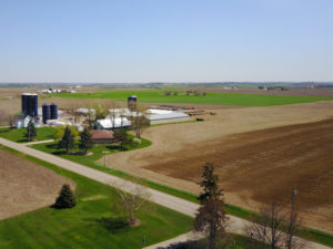
How much land is needed for a livestock nutrient management program?

What areas benefit the most from an infield bedrock verification survey?
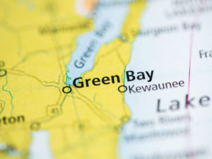
Summary of the HYDROGEOLOGICAL CHARACTERIZATION OF THE TOWN OF LINCOLN, KEWAUNEE COUNTY, WISCONSIN
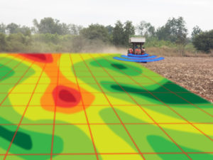
What is top of bedrock?

Geology, Groundwater, Geophysics, and WI DNR NR 151 Runoff Management Standards

A History of Groundwater Protection Past Present and Future

References and links for agricultural professionals, farmers, engineers, geologists, geophysicists,…
